Cameroon: Trees, water, soil and endangered wildlife
- Natalie Harvey
- Apr 1, 2018
- 16 min read
Mount Bamboutos is part of the 'Western Cameroon Highlands volcanic line. It is north of the Equator at the border region between Nigeria and Cameroon. It is an area of global biodiversity importance that includes the endangered Cross River gorilla.
Though today a highly productive landscape for its people (with the use of external nutrients through fertilizers and even pesticides), what will Mount Bamboutos be like in 10 or 20 years under the current trend of increasing population, farming and forest loss?
The "Mount Bamboutos Initiative" (MBI), a project of the International Tree Foundation (ITF) with the Environment and Rural Development Foundation (ERuDeF), aims to support a more sustainable path in Mount Bamboutos over the next 15 years through reforestation. It will connect altogether community forests, riparian forests, sacred forests, protected areas, and agroforestry systems.
The area holds the possibility to plant 3 million trees across 150km(2) or the size of Denver airport in Colorado (USA), under the following land use categories:
Community Forests (1) and sacred forests (33% of the total project area). It represents the potential for planting 1,300,000 trees.
The land was proposed as an 'IUCN category 4-6 Biodiversity reserve' (40%). It represents the potential for planting 600,000 trees.
Riparian areas forests (outside those inside Community Forests and the reserve) (4%). It represents the potential for planting 300,000 trees.
Private small lands (23%). It represents the potential for planting 800,000 trees.
Treesisters has been partnering with ITF on MBI since 1st April 2018 in the southwest portion of Mount Bamboutos. The partnership aims to plant 600,000 trees over three years and 3,000 hectares ( equivalent to 4,000 soccer fields). The project will involve and benefit 1,000 households drawn from 3 villages.
Geography
Mount Bamboutos is a volcanic massif located in western Cameroon. It is a very rugged and varied landscape with several high peaks, steep slopes and deep valleys. One of its peaks is the 3rd highest in Cameroon, jutting up to 2,740 meters. An extinct caldera of sub-elliptical shape (16x8 km) sits at the heart of the massif, with rock blocks covering its floor.

Mount Bamboutos massif spans three administrative regions of Cameroon (southwest, west and northwest), five divisions (Bamboutos, Menoua, Mezam, Momo and Lebialem) and eight subdivisions. It is mainly inhabited by the Bamileke tribe. Southwest and northwest are primarily English-speaking, and western Bamboutos are primarily French-speaking.
(Photo: Mount Bamboutos mountain tooth ©ERuDeF.)
Mount Bamboutos include tropical wet montane forests above 1,700m of altitude, also called cloud forests, as well as tropical sub-montane forests in the lower slopes of the mountain range from 1,100 to 1,750 meters.
Climate and Soil

It is a place of high annual rainfall (2,000 to 3,000 mm) and humidity. The climate is characterised by the alternation between a wet and a dry season of variable intensity. At Dschang, a city at 1,380m high, the temperature is mild throughout the year with an average temperature of 18.9°C, with the highest monthly mean of 23.4°C between March and April and the lowest (14.3°C) in December (2).
Mount Bamboutos' forests sit on soils with andic characteristics (3), which means they hold considerable soil fertility but great vulnerability to land degradation. Tree removal and today's agricultural approach are certainly not the most appropriate. Heavy rainfall and steep slopes lead to significant soil erosion and landslides.
Photo by EruDef, Regent Chief of Formenji, pointing at the degraded community forest in Formenji Bamumbu to be restored.
History of the Mount Bamboutos forests
A map of Mount Bamboutos' massif created in 1957 by the French Geographic Institute (IGN) (4) shows that land cover at the highest altitudes included primarily tree and shrubby savannas, as well as grasslands. Forests were only found in the valleys and along streams as forest galleries and on very steep slopes. On the flat elevations, trees were associated with horticulture and crops, surrounded by grasslands/pasturelands and steppes for livestock grazing.
In the 1970s, the populations living in the densely populated piedmont (5), a gentle slope leading from the base of the mountain to a flat land region, suffered from declining crop yields and a lack of jobs. They started to expand upwards. Settlers found the necessary water, cool temperature, and highly fertile volcanic soils to grow marketable vegetables there. More people means firewood harvesting, livestock grazing, and more shifting cultivation and agriculture lands.

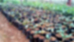
Consequently, today, the massif's piedmont and slopes support a polyculture of coffee and food crops (6) and are a densely populated area. 4,000 people settled inside the caldera to grow potatoes, cabbages, leeks, carrots and maize (7). Farmers of the southern flank of Mount Bamboutos raise pigs, goats and hens.
In the northwestern and western portions of the mountain, forests are much degraded and mostly found in deep valleys and along streams (8). Only southwest of Mount Bamboutos, where TreeSisters is involved, remains the most forested portion of Mount Bamboutos.
The caldera floor is quite deforested, and that was probably true even in the 1980s, as shown by a study that assessed forest loss by 5.8% between 1980 and 2016 (9).
The very small 'Mount Bamboutos Forest Reserve' of just 215 hectares created in 1900 by the Germans ‒reconfirmed successively by the French in 1947 and by the Government of Cameroon in 1972, has since been wiped out. In 1957, the forest no longer existed in reserve; it was already covered in trees and shrubby savannas, as shown by the map created by IGN.
Trees still form parts of the farming systems at the piedmont, but this is not the case on the horticulture farms located up the mountain where space is limited. Historically, the upper parts of the mountain have been used for grazing by the pastoralist community. Additionally, horticulture requires irrigation and can only take place near a stream.
The forests of Mount Bamboutos have also suffered from overexploitation. African stinkwood (Prunus Africanus) was completely decimated by the early 1990s due to overexploitation by the French pharmaceutical company Plantecam Medicam and the local people for its bark, known to treat prostate cancer in men.

Land cover/land use change in the MBI project area. Map produced by ERuDeF.
Note: CTE refers to the large private commercial tea plantation. Sparse vegetation refers to the remaining areas of partial forest cover.
Plant, Tree Variety and Wildlife
In spite of the catastrophic loss of montane forest and loss of exclusive birds ‒as it was described as the richest biodiversity hotspot for birds in all of west and central Africa, Mount Bamboutos still harbours incredible biodiversity, especially in its southwestern portion where TreeSisters is involved. This is no longer true for the slopes of the mountain in West and Northwest Mount Bamboutos.

Mount Bamboutos forms part of the Cameroon Highlands ecoregion (10), one of the world's 200 ecoregions of primary importance. A survey conducted in 2010/2011 found that 100 plant species belonging to 82 genera were identified at sub-montane and montane altitudes, with the genera Cola and Psychotria being the most represented (11). Some plant species are under the IUCN's Red List, such as Ternstroemia spp and Allanblackia gabonensis.
Southwest of Mount Bamboutos still harbours a high diversity of mammals, including the endangered forest elephant, the endangered Preuss' guenon (Cercopithecus preussi), the critically endangered Cross River gorilla (Gorilla gorilla diehli), and the most endangered Nigeria-Cameroon chimpanzee (Pan troglodytes ellioti).
Only 300 individuals of Cross River Gorillas remain in the wild, scattered across 11 isolated, tiny remaining sub-populations found in the remaining montane forests. Unable to adapt and cope with diseases and vulnerable to inbreeding, their reproduction is difficult. They are labelled as critically endangered (12). Three protected areas were created in the past ten years for the conservation of Cross River Gorilla, within which one sits in our project area, namely the Tofala Hill Wildlife Sanctuary.
Mount Bamboutos still harbours today birds that are endemic to Cameroon such as the Bannerman's Turaco (Tauraco bannermani), which is critically endangered, the endangered Banded Wattle-eye or Bamenda Pririt (Platysteira laticindra), which is only known in Mount Bamboutos and nowhere else on Earth. But for how long in small isolated fragments of the forest below unsustainable population levels?
Water Catchment

Mount Bamboutos is the 2nd most important water tower in the country, but it is already losing its function as a water catchment. Streams dry up in the dry season (13). Horticulturalists need to tap into streams to irrigate their crops in the dry season. Due to ever-shrinking forest cover, the watershed does not recharge sufficiently during the rainy season.
Water extraction is having an impact on 81,257 people living downstream (14). It puts at risk the functioning of the country's two major hydroelectric plants fed by streams generated by the Mount Bamboutos water catchment. Moreover, communities are fighting, and pastoralists are blaming the horticulturalists.
One of the big problems is that irrigated horticulture is being practised on the mountain's upper slopes, so water extraction is taking place at the very top of the catchments. And that is often where the springs emerge.
"It seems that what has been most important was to build pipes for water distribution, but no one had ever thought before of where that water was coming from ..." - Louis Nkembi, ERuDeF's CEO.
Soils

Without tree cover, soils dry out fast during the dry season. Cultivated soils on the slopes are exposed to erosion. Frequent hazards of meteorological origin coupled with the geological and geographical context of the mountain ranges do cause landslides, and rock falls (11). This is exacerbated by bushfires set up by local people and deforestation.
Population and Health Risks
Today, high yields in horticulture are supported by costly and polluting external chemical inputs. Community members use significant quantities of agricultural chemicals on horticultural crops. Fungicides are applied on potatoes using knapsack sprayers, with little or no personal protection. Chemicals are sprayed right at the top of the catchments, causing water pollution downwards. There is a widespread concern amongst the community about the potential health risks resulting from the contamination of water sources with chemicals. There are reports of high cancer rates in the area. Unfortunately, the shrinking and degraded forests are no longer acting as good filtering systems.
It seems horticulture the way it is practised today is not sustainable and probably not the most appropriate land use on the upper slopes of Mount Bamboutos. And Eucalyptus trees planted at the lower slopes are probably not the most indicated species of trees in the context of decreasing groundwater level, in addition to inducing soil degradation and decrease of biodiversity.
The approach
While remaining forests will be set aside for conservation, new ones will be planted along streams and around springs, on degraded farms, in sacred forests and in existing or future community forests. The project also aims to regreen farmlands with 'agroforestry trees'.
Reforestation will take place as the result of a participatory land use planning (15) process, which is likely to control the expansion of horticulture activity on the top of the mountain range, especially near the streams and springs.
Some farmers will move away from monoculture crop farming and animal husbandry to switch to tree-based farming, other activities, and possibly other more sustainable farming practices.
Participants during a training workshop on agroforestry, contour farming, etc. in M'muockmbie in November 2018
Who is involved?
The initiative puts local people at the centre of the project. They are the most suitable people to take care of Mount Bamboutos' trees and forests. Personal ownership is necessary for the project's success. It is also in alignment with Cameroon's decision to devolve some of the forest management to the local communities.
"Working with communities and local leaders is a key starting point for the MBI to bring the mountain under more sustainable management." - Paul Laird, ITF.
Prior to the project start, ERuDef met with the local leaders of the 3 clusters of villages, namely Bamumbu, Fossimondi and Fosi-M'muockmbie - Bamumbu is the largest cluster in the southwestern region of Mount Bamboutos. Then, the community leaders walked to the surrounding 16 villages for community awareness and consultation.
"The local people have clearly said that water quality and access is their primary concern." - International Tree Foundation.
Project activities
Community meetings/workshops to raise awareness and mobilise around the fragile Mount Bamboutos ecosystem and its management of 3,000 households for more sustainable livelihoods.
Training and consultation on sustainable, diversified farming systems for raising awareness and engagement of at least 2,000 farmers (agroforestry, contour farming, fruits and NTFPs tree growing). This includes identifying tree species to be planted, agroforestry nursery establishment; training on pegging, grafting, marcotting, composting, harvesting and tree treatment, etc.; training on monitoring the monitoring of agroforestry and sustainable farming crop yield plots in the three villages. This is expected to result in the planting over 240,000 agroforestry trees on the farms by the farmers themselves.
Value chain development, based on the processing or trade of substances, materials and/or commodities obtained from forests or trees which do not require logging the trees, will lead to increased incomes and employment. This will be possible through consultation to identify potential new income sources and cottage industries, constraints, and opportunities, as well as training on the cultivation of NTFP and fruit trees.
Planting 360,000 native trees to restore degraded Mount Bamboutos' forest ecosystem. This involves establishing seven tree nurseries (equipment and seed procurement) and identifying the priority areas for restoration intervention in the designated community, riparian and sacred forest areas. Secondly, it requires training to operate the tree nurseries and monitor planted seedlings' survival rate.
Environmental Outcomes
The protection and conservation of water catchments. The trees will help attract rain, retain water in the soil and recharge groundwater tables. The trees will keep nutrient pollution from agricultural sources out of the water by recycling excess nitrogen and reducing soil erosion.
The increase in biodiversity, habitat and corridors. By establishing a connective network of forests with a high diversity of trees and indigenous tree species, many mammals, birds, insects, reptiles, and other micro animals and bacteria are expected to pop out across the landscape.
Increased tree cover within agricultural areas will contribute to (1.) and (2.). On farms, a variety of trees increases the presence of pollinators and other beneficial fauna and flora to the cultivated crops.

The project will also help farmers reduce their reliance on external inputs. The trees planted within farming systems will help minimise nutrient losses and maximise the internal cycling of nutrients. Farmers will be encouraged to adopt low inputs practices or methods; for example, through the use of nitrogen-fixing species, which improve soil health and fertility, or planting the right kind of crop and tree diversity to enhance pest and disease control.
It will also contribute to soil conservation and landslides. Training farmers on methods appropriate to steep slopes will help reduce devastating soil erosion and landslides. For instance, lines of trees can be planted across the slope along the terrace edges that follow the land's elevation contour lines.
Socio-economic outcomes
Increased income. First, reforestation directly employs locals. They are also encouraged to generate their sources of income through training on cultivating and processing fruit and other non-timber forests/tree products. Moreover, regreening farms with trees will help liberate farmers from dependency on and the cost of chemicals.
A cycle of empowerment. First, the project supports the communities involved to relate differently to trees and forests. They are called to work together to restore the ecosystem that gives them life. It empowers them to participate in forest management and conservation. They learn that it is possible to earn a living from growing and planting trees, not only from cultivation and the extraction of timber and non-timber from the forest. More sustainable land use activities and land cover may arise. For example, personal and commercial use of timber and non-timber products from the remaining tracts of forest may be replaced by sustainable avocado food and commercial production (not in place of the forest) and cottage industries.
Method and trees

The project is planting 60% of trees for reforestation purposes. The other 40% are agroforestry trees planted on farms. The project will artificially plant tree seedlings, grafted trees, wildlings (16), etc., of a wide spectrum of species adapted up to 1,900m elevation.
Over ten exclusively native species of trees will be planted for reforestation in the "to-be-created" biodiversity reserve and sacred forests, community forests and along streams. Some are only found in the Cameroon Highlands ecoregion, while some have a wider distribution and are present all over Africa. A non-exhaustive list of the reforestation species includes:
Vulnerable Terminalia ivorensis is a good colonizer of abandoned farmlands and timber species. Naturally occurs in the countries bordering the Gulf of Guinea.
A pan-African montane tree species, African Cherry or Red stinkwood (Prunus Africana), prized for its tough hardwood, is useful for producing hoe handles, utensils and floors.
Diospiros spp. with Diospyros kupens being an understory.
Several Cola species. Cameroon hosts the world's greatest diversity of Cola species.
Entandrophragma Angolensis, a dry-deciduous tree in sub-Saharan Africa, is classified as vulnerable by IUCN. This will be planted in well-drained areas with high annual rainfalls, planted up to an elevation of up to 1,800 metres.
Most of the seeds for agroforestry trees will be directly collected by ERuDEF. A few will be purchased by ERuDeF and then distributed to farmers. Over seven species of agroforestry trees will be planted, with at least 70% native species. Non-native species include Malus domestica (apples) and Persea Africana (Avocado). Agroforestry trees will be planted on private lands, interspersed with settlements and agriculture, within community forests and inside the boundaries of the proposed protected area (17).
How is it organized?
ERuDeF, a local non-profit organization, with long-term experience in forest and wildlife conservation and reforestation, with the support of a youth group called "Operation Green Space", implement, organise and oversee the reforestation work in the southwest region. OGS is a relatively new and inexperienced organisation; hence they benefit from training and mentoring from ERuDeF.
At the community level, the village administration, with the help of the village's Forest Management Committee (18), is the main parties making decisions and managing the forest restoration work. Community based organization and cooperatives are involved in the creation and management of tree nurseries associations and planting.
At the household level, volunteer households enroll and set up their own tree nurseries. They grow agroforestry trees or trees of economic value that will be planted on degraded farms.
At Government level. The Government of Cameroon will be involved to ease the management of the governance structure that will be set up. The Government, through the Ministry of Forests and Wildlife (MINFOF), will appoint a Focal Person to oversee the growth and management of this project.
Louis Nkembi, ERuDeF's CEO, has built an impressive constellation of people and strong organisations to help make the aims of MBI a reality over the coming 15 years, including:
Government authorities and agencies in the three regions straddled by Mount Bamboutos.
Traditional leaders through the formation of the Mount Bamboutos Fons' (19) Association.
Municipal councils through the formation of Mount Bamboutos Municipal Councils Association (under development)
Pastoralists, through developing good relations with the Mbororo Social and Cultural Development Association MBOSCUDA
Local NGOs such as COMAID and GADD (Groupement d'Appui pour le Développement Durable) and ACREST (African Centre for Renewable Energy and Sustainable Technology).
MBI is funded by several donors who fund under their specificity. Trees for the Future (TFF) focus on 'forest gardens' – agroforestry and household tree nurseries. IUCN Cameroon, which is involved in most of the area earmarked for TreeSisters, supports small-scale interventions with several partners across a wide area. Darwin Initiative is funding work in the west and northwest and some aspects of the mountain-wide participatory land use planning.
The place of women
ITF and ERuDeF will ensure the following:
Women and men gain equal knowledge and skills in nursery establishment and tree planting for the restoration of Mount Bamboutos' degraded ecosystem.
Women and men gain equal knowledge and skills and adopt sustainable, diversified farming systems (through training on agroforestry nursery establishment, pegging, grafting, marcotting, propagators, composting, planting, harvesting and treatment).
Women are primarily encouraged to take steps towards increased income through agroforestry and non-timber forest products. The goal is to have 70% of the households having female entrepreneurs or workers - as part of women-led associations (e.g. Mount Bamboutos Women Association) or enterprises (women cooperatives, enterprises and cottage industries) earning an increasing income from establishing their own small agroforestry tree nurseries or from the cultivation of fruit trees and Non-Timber Forest Products (NTFP).
Map of the MBI project area with the different founders involved. TreeSisters funds reforestation in the southwest section of Mount Bamboutos only. Map produced by ERuDeF.
"In Cameroon, women have traditionally been considered as dependent on their men for economic survival. Most of the income generated in the area is controlled by the men, even though women may be doing most of the work." - Provided by ITF.

ERuDeF's Centre for the Advancement of Women Initiatives will ensure that women and gender considerations are included and become accepted into all aspects of the project. One of the goals is that women-led associations and enterprises will be integrated into the governance structures being developed in the initiative. ITF and ERuDef are also helping set up a platform to help well-organised women build their businesses and find the financial support they need.
Announcement
The Lebialem region was affected by insecurity six months after the project started. There have been violent and deadly clashes between demonstrators and Cameroonian security forces. It is not always safe to travel in the area, and not always easy to work there. Restrictions, including night curfews and banning public meetings, may occur.
The insecurity impacted the communities and project in several ways:
In some cases, rural communities had to abandon their homes and farms to avoid attacks by separatists or the army and seek refuge in the forest or in nearby towns.
For security reasons and the impossibility of acquiring authorisation, it was difficult to call public meetings for the project.
It was difficult for project staff to visit all the working areas – travel has to be planned carefully to minimise risks.
To avoid curfews and intentional internet disruptions, ERuDeF had to move the project team up to Dschang, the nearest big town on the French Speaking side (less impacted).
These factors have resulted in some delays in project implementation: the planting could not happen in the first year. However, many villagers remain on their farms to protect them and to continue farming to feed their families. ERuDeF and ITF believe it is feasible to catch up with the target of planted trees this coming planting season.
"We are very proud that the team on the ground has been able to launch and initiate the programme and move practical activities forward with local communities despite the challenges of the ongoing crisis in Cameroon." - Paul Laird, ITF.
Timeline
April 2018: Project start date.
June 2018: Andy Egan, ITF Chief Executive, and Paul Laird, ITF Programmes Manager, visited Mount Bamboutos in Cameroon as one of the first steps to establish the new Mount Bamboutos Initiative (MBI)
Aug 1st, 2018: MBI Inception workshop and follow-up community awareness workshops to educate people in three villages about the importance of restoration and sustainable management of the Cameroon Highlands forest.
Oct/Nov 2018: insecurity started.
March 2018: Paul Laird, ITF Programmes Manager, visited Mount Bamboutos but was not allowed to go southwest because of advice against all travel. He spent two days in the field with ERuDeF team.
April to July 2019: First planting activity.
Outcomes
Reached out to bring people and institutions together and implemented practical work with communities, including farmer training and the establishment of 6 tree nurseries.
Baseline botanical surveys with the production of a plant inventory list. Identification of the priority sites for reforestation through participatory land use planning meetings and community decision-making.
Seed supply systems. ERuDeF has set up a system for local seed collection since Cameroon does not have a good centralised seed collection system. In addition to seeds, wildlings of some species, such as Raphia, are collected to be grown in the nurseries. Avocados are grown from seeds, and the seedlings are then grafted with scions from high-yielding varieties.
Six tree nurseries are now established, equipped and operational: Magha, Formenji, Nchingang in Bamumbu; Ajangeum Fonang in M'Mouckmbie; Mbelenka and MBa-M'muock in Fossimondi.
The following indigenous and agroforestry species of trees are growing in the tree nurseries: Cola acuminata, Canarium schweinfurthii, Ricinodendron heudelotii (stimulant), Maesopsis eminii, Raphia vinifera (20), avocados, Entandrophragma angolensis and Croton macrostachyus.
Footnotes:
1. A forest are managed by communities who occupy the land and depend on for their living. 2. Open Archive Toulouse Archive Ouverte (OATAO). Available here. 3. Tematio, P et al. 2004. Soils and their distribution on Bambouto volcanic mountain, West Cameroon highland, Central Africa. Journal of African Earth Sciences. 39: 447-457. Available here. 4. At the time it was given to France and Britain to rule Cameroon. 5. In 1992, the population density at the piedmonds was 150-300 people/km2 Available here. 6. Ngoufo, R. 1992. The Bamboutos Mountains: Environment and Rural Land Use in West Cameroon. Mountain Research and Development. 12(4): 349-356. doi:10.2307/3673685. Available here. 7. Zangmo Tefogoum, G., Nkouathio, D.G., Kagou Dongmo, A., Wandji, P., Gountie Dedzo, M., Tchoua, F. M. 2012. Mount Bambouto caldera (Cameroon Volcanic Line): formation, structure and environmental impact. Bulletin: 1. 14 - 20. Available here. 8. Ngoufo, R. 1992. The Bamboutos Mountains: Environment and Rural Land Use in West Cameroon. Mountain Research and Development. Vol. 12 (4): 349-356. Available here. 9. Toh, F. A. et al. 2018. The Socio-Economic Impact of Land Use and Land Cover Change on the Inhabitants of Mount Bambouto Caldera of the Western Highlands of Cameroon. Advances in Remote Sensing. 07: 25-45. Available here. 10. Google KML available here in WWF pathfinder. 11. Fonge, B. A. et al. 2013. Diversity, Distribution, and Abundance of Plants in Lewoh-Lebang in the Lebialem Highlands of Southwestern Cameroon. International Journal of Biodiversity. Article ID 642579, 13 pages. Available here. 12. By IUCN. Source here. 13. From International Tree Foundation here. 14. Number taken from here. 15. From the ROAM exercise. 16. Seedlings grown in natural conditions. 17. In Cameroon, protected areas may be a mix of forest area and agriculture area. 18. A government-mandated structure reactivated and animated by ERuDeF and is responsible for the village's forest management. 19. A Fon is a king of a region of Cameroon. 20. A native species of palm tree (west and central Africa). Abundant along cross river. Stems are used for building mats. Nuts used to produce wine. Not a palm oil tree.